
Site banner

On this date in 1757, the Toronto shoreline was first detailed on a French map. It identifies the Credit River, the Humber River, Fort Rouillé on the Exhibition Grounds, and the Scarborough Bluffs (via @muddyyork.bsky.social)
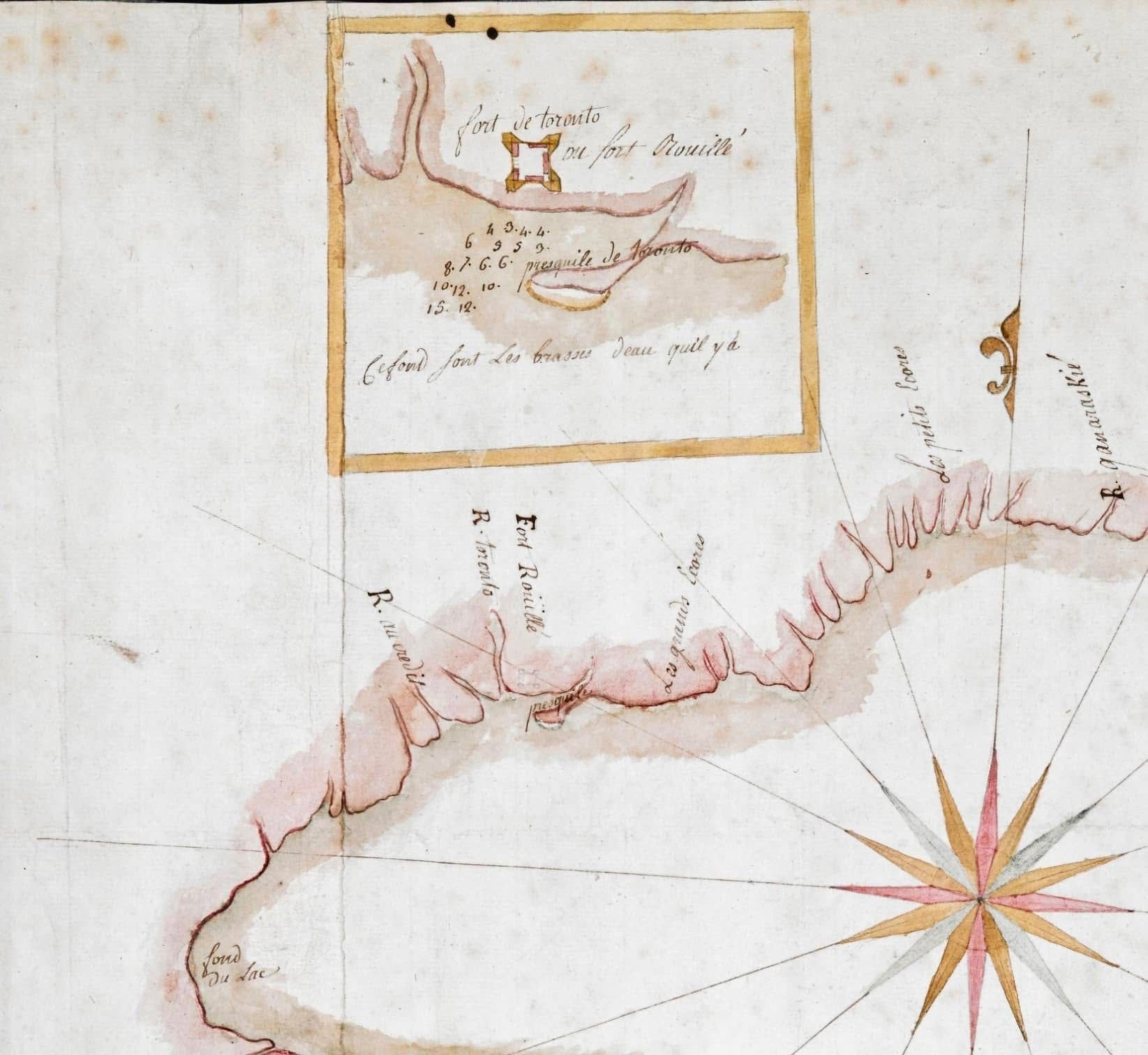
A historical hand-drawn map with faded colours, primarily in soft pink, brown, and beige tones. It depicts a coastline with rivers and bays, including a large compass rose in red, yellow, and black at the bottom right, pointing directions. In the top left, an inset map shows a small fort labelled “Fort de Toronto ou fort Rouillé,” drawn as a simple square structure with bastions along a curving shoreline. The inset also includes a series of numbers and the phrase “pequinite de Toronto,” along with a note about water depth. The main map labels several rivers, including “R. Toronto” and “R. naumaviin,” a location marked “Fort Rouillé,” and the “les grands bois” along the shore. The coastline is shaded pink, with sketched trees or hills indicating terrain, and the water areas are left mostly blank except for key markings. The bottom left corner of the map is labelled “Fond du Lac.”
*****
Written on