Site banner

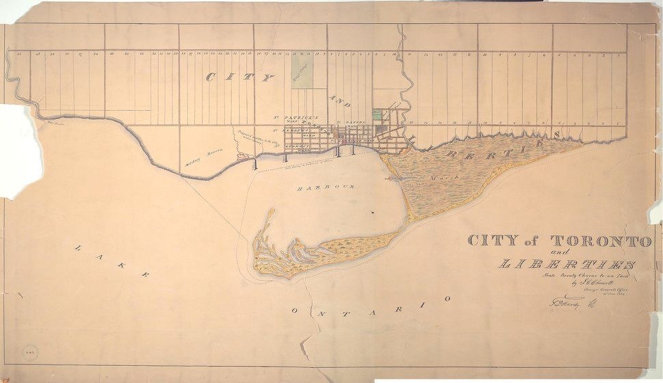
On this date in 1834, the first map of the newly created city of Toronto was completed.

(via bsky.app/profile/m…)

An old, sepia-toned map of the City of Toronto and surrounding areas, showing Lake Ontario at the bottom with a large harbour and a sandbar island. The city grid is drawn in the centre near the waterfront, with streets and blocks neatly laid out. To the north are rectangular plots of land divided into concessions and lots, with some waterways and creeks marked. The harbour is labelled, and a marshy area is indicated along the eastern shoreline. The map’s title in the lower right reads “City of Toronto and Liberties,” followed by a note about the boundaries and the surveyor’s information in decorative script. Edges of the map are torn and worn, with visible folds and creases.
*****
Written on