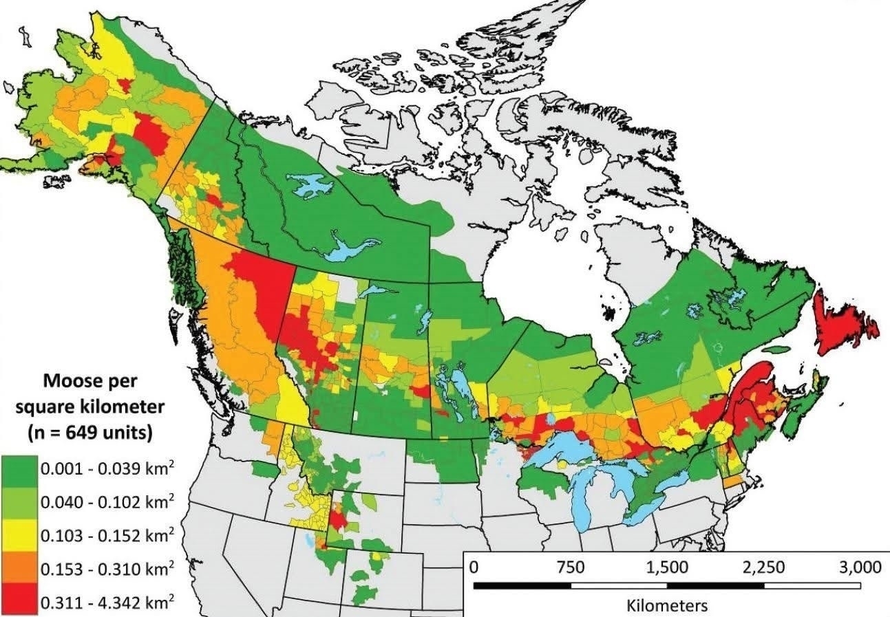
Canada and our moose map (via @MeanwhileinCanada@ohai.social)

Map showing moose density per square kilometer in Canada and parts of the northern United States, color-coded to represent different density ranges. Areas with less than 0.039 moose per square kilometer are in green, 0.040 to 0.102 in light green, 0.103 to 0.152 in yellow, 0.153 to 0.310 in orange, and 0.311 to 4.342 in red. Coastal and northernmost regions of Canada are shown in gray, indicating insufficient data. A scale bar at the bottom indicates distances in kilometers, ranging from 0 to 3,000.
*****
Written on